Helping construction, engineering, and inspection teams reduce costs by up to 20%
From data capture to inspections, we provide reliable aerial data that helps you spot issues early and keep projects moving.


Our Services.
We help construction, engineering, and infrastructure teams gain clear, reliable site intelligence without slowing down operations.
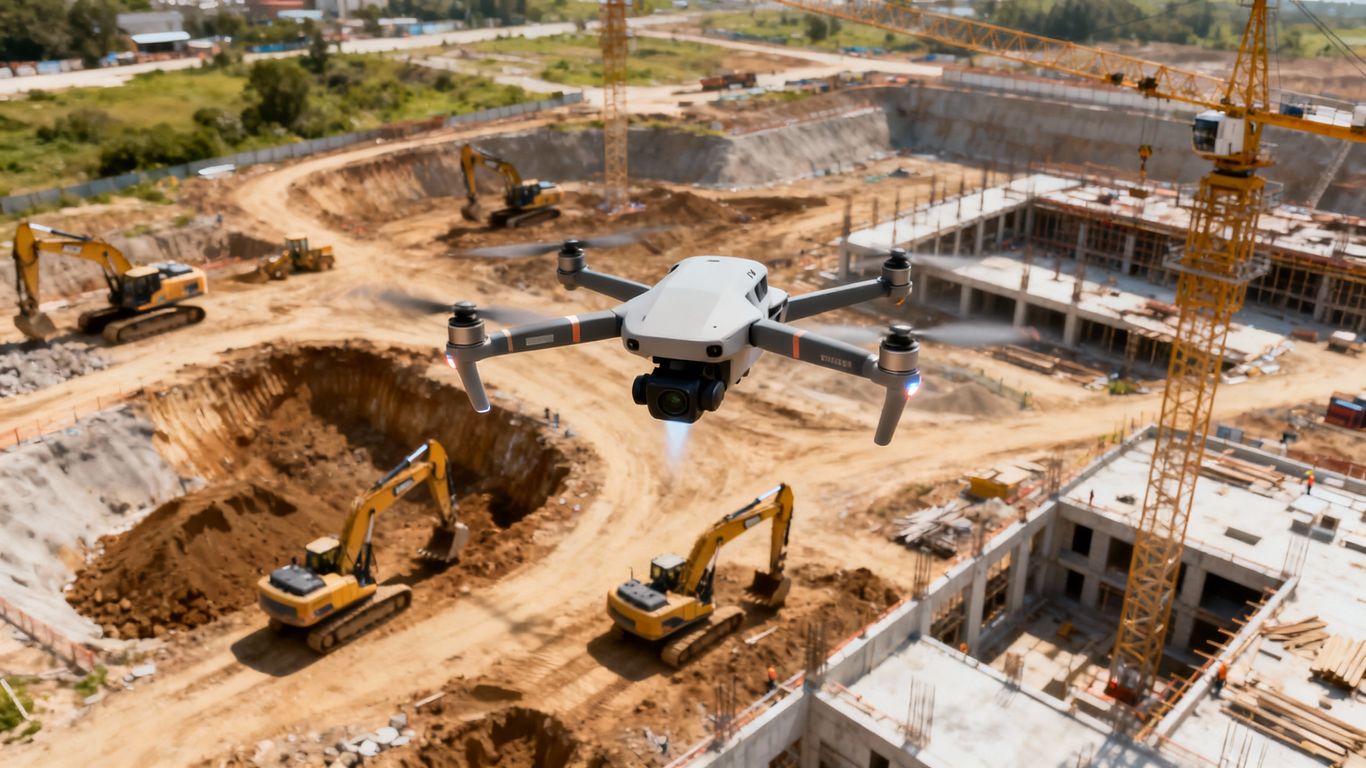
Construction Progress Monitoring
Consistent aerial documentation that keeps stakeholders aligned, reduces site visits, and provides visual proof of progress.
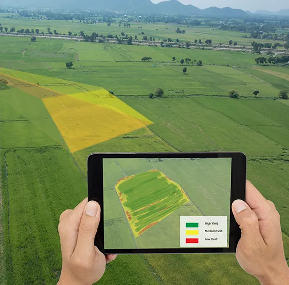
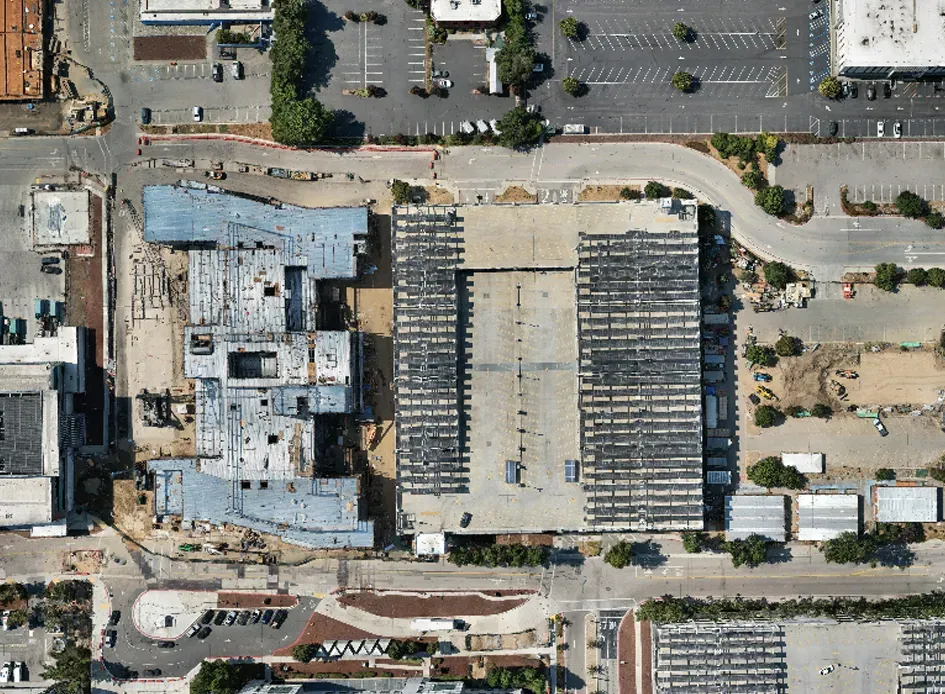
Aerial Data Capture & 3D Modeling
High-resolution orthomosaics, 3D models, and volumetric visual estimates that support planning, earthwork tracking, and progress documentation (for planning and visualization purposes only).
Commercial & Infrastructure Inspections
Safer, faster inspections for roofs, bridges, utilities, and structures — without scaffolding or shutdowns.
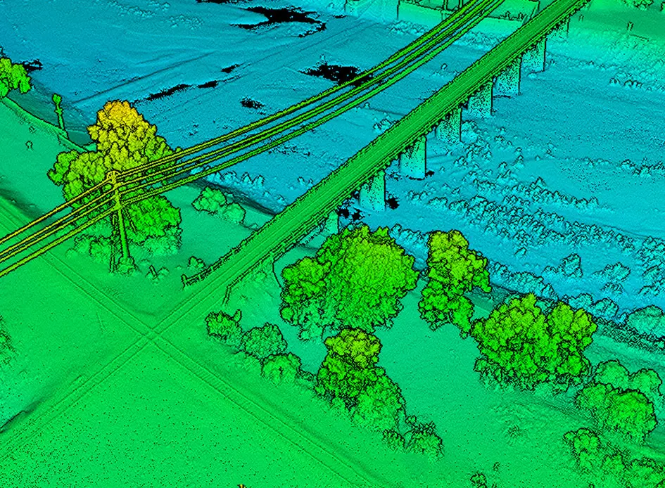
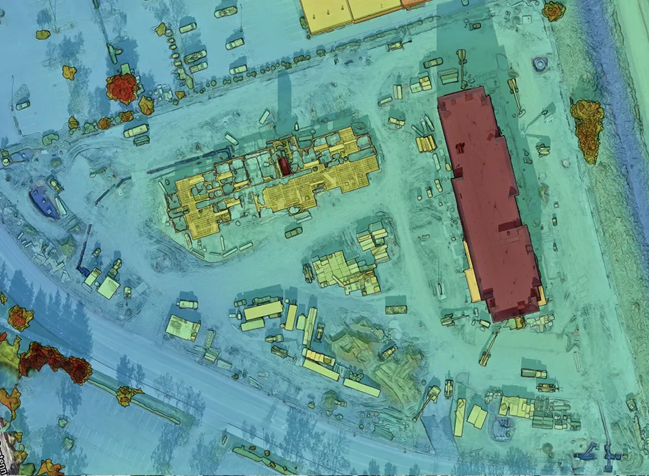
LiDAR & 3D Data Services
Detailed terrain and surface data for complex sites where richer 3D information matters most.
Thermal Inspections
Thermal imaging to identify heat loss, electrical issues, moisture intrusion, and system inefficiencies early.
Custom Drone Solutions
Project-specific data capture designed around your scope, timeline, and deliverables.
simple, reliable 4-step system
Our Process.
We’ve removed complexity so you get results — FAST.

1. Scope & Quote
A quick call to understand your site, objectives, and deliverables. You receive a clear, custom quote with no surprises.
2. Flight Planning & Compliance
We handle FAA compliance, airspace authorizations, and safety planning so your project stays protected.
3. Data Capture
Certified pilots collect high-resolution imagery and data without disrupting site operations.

4. Delivery & Support
You receive organized, easy-to-use deliverables ready for sharing, reporting, and decision-making.
Why Clients Trust the Process.
Trusted by Professionals Who Need Reliable Data
What our clients say.
“Doubled Our On-site Efficiency”
“Aeroskape’s aerial solutions doubled our on-site efficiency by providing reliable, timely data that helped preempt potential issues.“
“Indispensable Part of Planning”
“The quality of Aeroskape’s imaging technology is unmatched, making it an indispensable part of our construction planning phase.”
“Reduced Our Costs by 20%”
“Thanks to Aeroskape, we reduced our project costs by 20% through more efficient planning and site management.”
About Aeroskape.
Aeroskape was built to solve a common problem in construction and infrastructure projects: a lack of clear, timely site visibility.

CEO
Too often, teams rely on manual inspections, delayed reports, or incomplete data to make high-impact decisions. That leads to missed issues, safety risks, and costly delays.
I built Aeroskape to change that.
We specialize in drone-based imaging, aerial data capture, and inspections that give project managers, engineers, and decision-makers the information they need — when they need it. Our data replaces guesswork with clear, visual data that’s easy to understand and act on.
What makes Aeroskape different is our focus on outcomes, not just flights. We don’t just collect aerial imagery — we deliver organized, decision-ready data designed around your project goals. Every flight is planned for safety, compliance, and quality, and every deliverable is built to support real-world use.
Clients choose Aeroskape because we’re reliable, responsive, and detail-oriented. We understand the pressures of schedules, budgets, and accountability, and we’ve built our process to support fast-moving teams without disruption.
If you need a drone partner who understands high-stakes projects and delivers clarity instead of complexity, Aeroskape is ready to help.
Click the button below to get a custom quote and see how aerial data can simplify your next project.
William Brown
CEO, Aeroskape
Frequently asked questions
faq.
Explore how Aeroskape – your trusted aerial imaging specialist in Northern California – transforms construction management.
Ready to take your construction projects to the next level?
Download our free eBook, Aerial Blueprint: The Construction Professional’s Guide to Drone Integration. Learn 7 essential strategies for saving costs, boosting efficiency, and enhancing safety with drones. Grab your copy now!

Our Service Area.
We offer aerial imaging, construction site monitoring, structural inspection services, and more across Central and Northern California.
Ready to Reduce Site Costs?
Click the button below to get started!
Disclaimer: Aeroskape, LLC does not provide Professional Land Surveying services. Aeroskape’s services do not include the determination of property boundaries, contours, monuments, or the authoritative position of land or fixed objects as defined under California Business & Professions Code §8726. All deliverables are provided for planning, visualization, documentation, and informational purposes only. When survey-grade or legal deliverables are required, clients should consult a licensed Professional Land Surveyor (PLS).